I had them in quick time and easy to fit
Great product for use on a rusty Campervan, really does kill the rust and puts a varnish like coating on the surface to seal it.
West London Boat Service & Repair
Servicing
|
Boat Sales
|
Parts
|
Chandlery
01932 247 427
Imray
Ref: KHYOT0090
Couldn't load pickup availability
Next day delivery may be possible for this item: please call 01932 247 427.
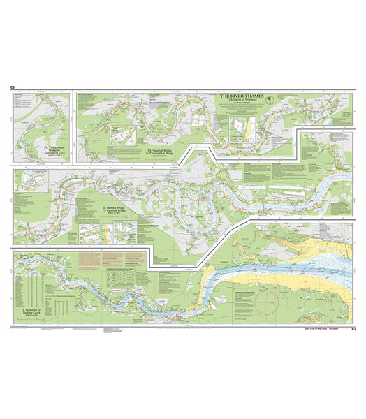
Durable to withstand wet and windy conditions, this Imray chart of the River Thames from Teddington to Southend makes plotting easier.
Good detail of the Thames from Teddington to Southend in three panels and various scales:
Plans include South Dock Marina, Limehouse Basin Marina, St Katherine Docks, Chelsea Harbour Marina, Brentford Dock Marina.
Digitally printed on water resistant paper and folded inside plastic wallet. Imray charts are officially recognised by the Maritime and Coastguard Agency for use on coded and fishing vessels under 24m in length. Latest correction notice available by scanning QR code.
Product code: C2 The River Thames
January 2024
Imray is the leading publisher of nautical information for leisure sailors.